Work Package 1
Conceptual Framework of Green Infrastructure Assessment
MaGICLandscapes partners investigated green infrastructure (GI) assessment approaches at the transnational level. This conceptual framework of GI assessment identifies specific informational needs regarding GI at the European, regional and local level and how GI Management approaches and implementation can support policies and objectives from various sectors at all territorial levels.
The conceptual framework assessed the green infrastructure resource at transnational and regional scale. The partners and associated institutions developed a remote-sensing methodology and ground-truthed it in selected case study areas. The re-integration of experiences and empirical findings delivered an iterative improvement, ensuring validity and that territorially specific needs are recognised in the transnational assessment development process.
Work Package Duration: 07/2017-12/2018
Coordination: Leibniz Institute of Ecological Urban and Regional Development, Marco Neubert
OUTPUTS
Handbook of Conceptual and Theoretical Background, Terms and Definitions (pdf 4.2 MB)
- Definition of GI and related terms
- GI in territorial laws/policies of the EU, Austria, Czech Republic, Germany, Italy and Poland
- Identification of needs for GI assessment in the 9 case study areas
Download fact sheet (pdf 640 kb)
The Handbook can be used as aid for supporting GI-related actions and investments.
Manual of Transnational Green Infrastructure Assessment - Decision Support Tool (pdf 8 MB)
- Geodata and its suitability for assessing GI
- Introduction to a GI ground-truthing method
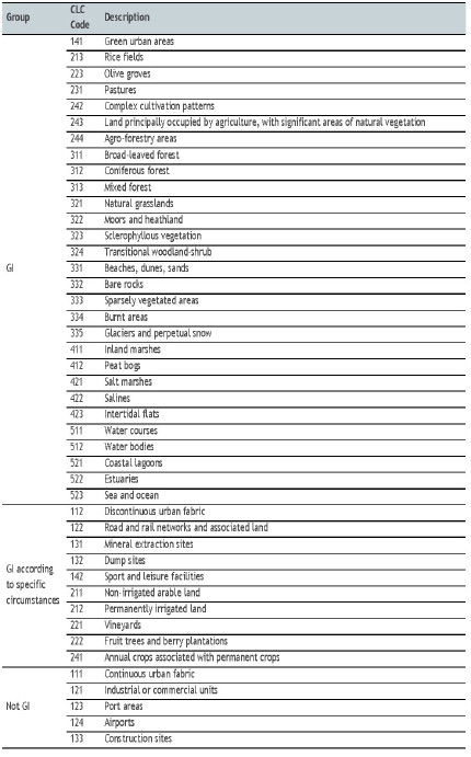
- Transnational GI classification scheme
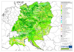
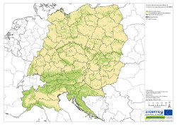
- Maps of GI in Central Europe and in each case study area
Download fact sheet (pdf 640 kb)
The Manual and the Regional Maps enable stakeholders all over Europe to map and assess the GI resource. The three outputs can be used as decision-support tools within regional planning and landscape management.
Final GI Classification scheme used for transnational mapping:


Green Infrastructure in central Europe based on CORINE land cover |

Where is GI in central Europe and where not? |
Regional Maps of Green Infrastructure for each of the participating regions
- Illustrate types and structure of GI at regional level by means of specific biotope and land use datasets
- Helps decision-makers to identify the regional/local GI resource
Regional GI Maps Kyjovsko (South Moravia, Czech Republic)
Regional GI Maps Dübener Heide Nature Park (Saxony and Saxony-Anhalt, Germany)
Regional GI Maps Karkonosze National Park (Lower Silesia, Poland)
Regional GI Maps Tri-Border Area Czech Republic, Germany, Poland
Regional GI Maps Krkonoše National Park (Liberec and Hradec Králové Region, Czech Republic)
Regional GI Maps Eastern Waldviertel and Western Weinviertel (Lower Austria, Austria)
Regional GI Maps Thayatal National Park (Lower Austria, Austria)
Regional GI Maps Po Hills around Chieri (Turin) (Piedmont, Italy)
Upper Po Plain (Piedmont, Italy)
For further information regarding regional data used for the GI maps please contact Work Package Coordinator Marco Neubert from the Leibniz Institute of Ecological Urban and Regional Development.
----------
Work Package 1 related presentations held on the IALE World Conference 2019 in Milan:
HENRIETTE JOHN (Leibniz Institute of Ecological Urban and Regional Development, IOER):
Green Infrastructure - Its knowledge in public and general assessment needs (pdf 1.2 MB)
MARCO NEUBERT, HENRIETTE JOHN (IOER):
Transnational Mapping of Green Infrastructure in Central Europe (pdf 3.1 MB)
Read on WORK PACKAGE 2 and WORK PACKAGE 3
Back to MAIN PAGE
