AIST Catchment in Austria
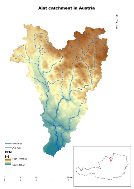
The Aist Basin was chosen as a pilot catchment in Austria because the existing topographical characteristics as well as the prevailing problems, pressures and water management measures make it an appropriate case study region for a NSWRM approach. It is a representative catchment for the Austrian part of the ecoregion Central Uplands (low mountain ranges with plateaus and gorges) in which all river catchments share one common problem: siltation from granite weathering, causing ecological problems as well as problems for water and flood management. Further issues in the Aist catchment are (a) hydromorphological deficits due to river regulations and flood protection measures, and (b) poor ecological status in several river stretches (assessment for WFD, Austrian Water Management Plan). NSWRM can help mitigate the existing problems in the catchment and improve conditions related to the aspects of water quality, sediment balance, nutrient cycle and habitat diversity.
Activities to improve the situation in the catchment are already included in various strategic national planning documents, based on the Water Framework Directive, e.g. action plans within the National Water Management Plan (NGP, 1st 2009, 2nd 2015) and the National Flood Risk Management Plan (HRMP 2015).
| Characteristic | Unit | Value |
| Character of catchment | Central Uplands | |
| Catchment size: | km2 | 647 |
| Average flow low/avg/high* | m3/s | 5.1/6.4/7.8 |
| Extreme flow low/high* | m3/s | 0.44/336.6 |
| Annual precipitation low/avg/high** | mm | 726/835/993 |
| Annual air temperature min/avg/max** | ºC | 5.4/7.1/9.5 |
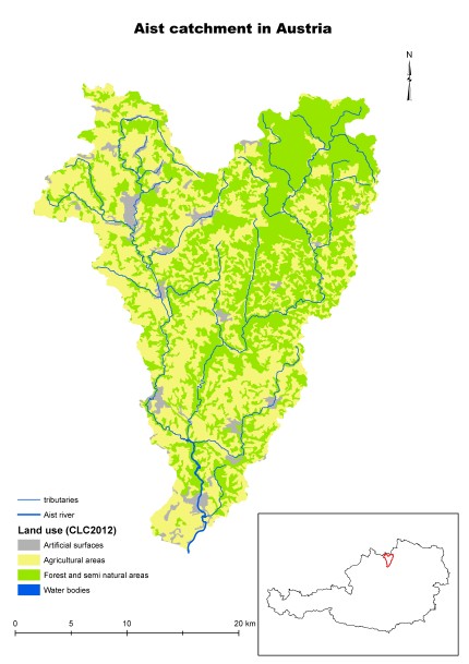
| Agriculture area*** | % | 48.9 |
| Urban area*** | % | 3.9 |
| Forest area*** | % | 46.8 |
| Open Water area*** | % | 0.01 |
| Flooded area (1/100 years) | km2 | 1.9 |
| Artificial drainage area | km2 | 0 |
| Ecological status no good/bad | waterbody | |
| Major problems to achieve good ecological status | Phytobenthos, Macrozoobenthos, NO3, o-P,DOC |
* From multiannual statistic 1984-2016
** From multiannual statistic 1981-2010
*** From CORINE LandCover 2012
The catchment area will be a testing ground for the GIS valorization tool for mapping potential locations of N(S)WRM as well as static tools for calculating the static effectiveness of those measures. Data obtained for the catchment will be used for testing dynamic tools (methodology) for calculating the dynamic system effectives of N(S)WRM (SWAT model for catchment analysis and HEC-RAS model for in-stream). The implementation of SWAT will provide highly detailed information on water, sediment and nutrient fluxes.
The analysis of the Aist river catchment will contribute to the improvement of the created tool functionality and design. The valorization tool will be applied to the catchment to assess the need for water retention according to multiple criteria (e.g. sediment, nutrients, habitats). The experience gained during the tool application will be used to prepare guidelines for improving water balance and nutrient mitigation by applying a system of N(S)WRMs and an implementation plan taking into account the relationship between the cost and effect. Stakeholder integration will occur through their engagement in the development of the tool.


